How Does GPS Work? Satellites, Trilateration, and the Secret of Time
 📷 Zelch Csaba · Pexels
✦ Key takeaways
- GPS finds your location by measuring the time signals take to travel from several satellites to you.
- You need signals from at least four satellites to fix your position in three dimensions accurately.
- Your device sends nothing; it only receives, which is why unlimited devices can use it at once.
- Without Einstein's relativity corrections, GPS would drift several kilometers every day.
You open the map app on your phone and a blue dot appears, marking your place on the planet to within a few meters, moving with you as you walk. We take this daily miracle for granted, but it is truly one of the most intricate engineering systems humans have ever built, combining satellites orbiting twenty thousand kilometers up, exquisitely precise atomic clocks, and even corrections drawn from Einstein's theory of relativity.
How does a small device in your pocket know exactly where it is among the millions of square kilometers on Earth's surface? The answer is a beautiful story about light, time, and geometry. Let us take it apart step by step.
Personal Budget Planner
Plan income & expenses, see your savings rate & 50/30/20 — live charts.
A Constellation Watching the Sky
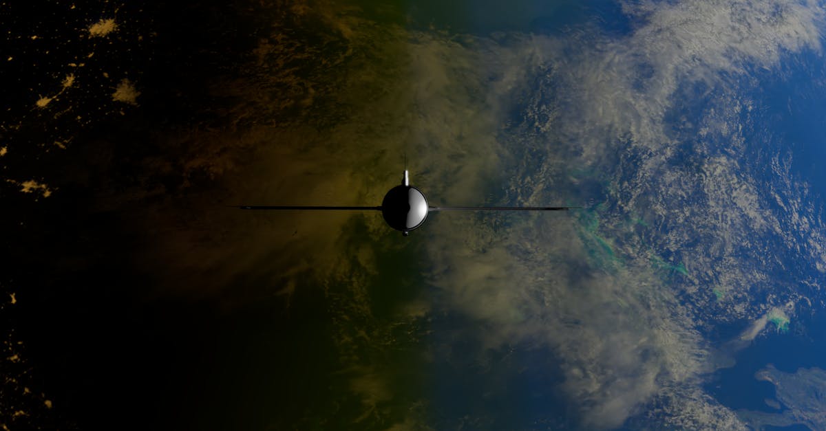
The system relies on a fleet of satellites, more than thirty in the American GPS system alone, spread across carefully chosen orbits so that any point on Earth can see at least four satellites at any moment, and usually more. These satellites orbit about twenty thousand kilometers high and circle the Earth twice a day.
Each satellite carries an ultra-precise atomic clock, the most accurate kind of clock in existence, losing only about a second every few million years. And each satellite continuously broadcasts a radio signal carrying a simple but crucial message: “I am satellite number so-and-so, my position at this instant is such-and-such, and the exact time now is such-and-such.” This signal races toward Earth at the speed of light.
The Core Idea: Turning Time Into Distance
Here lies the heart of the system. When a satellite's signal reaches your device, your device compares the time written in the message with the time it actually arrived. The difference between them is how long the signal took to travel from the satellite to you. Since the signal moves at the known, constant speed of light (about three hundred thousand kilometers per second), your device can compute your distance from the satellite by multiplying time by speed.
But knowing your distance from a single satellite is not enough. It only tells you that you lie somewhere on the surface of a huge imaginary sphere centered on that satellite, with a radius equal to the calculated distance. You are somewhere on that sphere, but where exactly? To narrow it down, we need more than one satellite.
Trilateration: How Spheres Intersect to Pin a Point
Imagine you know your distance from two satellites. Now you lie on the surfaces of two spheres at once, and the intersection of two spheres is not a point but a circle. Add a third satellite, and you are on the intersection of three spheres, which narrows down to just two points in space. Usually one of the two points is far out in space or below the ground, so your device rules it out logically, leaving one sensible point: your location.
This process is called trilateration, or positioning by distances. In theory three satellites suffice, but in practice we need a fourth for an important reason: your device's clock is not an atomic clock and is not accurate enough. The fourth satellite provides an extra equation that lets the device correct its own clock error, syncing its time to the satellites' atomic time and yielding an accurate position in all three dimensions: longitude, latitude, and altitude.
Your Device Only Listens, It Never Speaks
A common misconception is that the GPS in your phone communicates with the satellites both ways, or that the satellites “track you.” The truth is exactly the opposite: your device is a silent receiver that broadcasts nothing toward the satellites. All it does is listen to the incoming signals and compute its own position.
This fact has two lovely consequences. First, there is no limit to how many devices can use the system at the same instant; whether one person uses it or billions do, the satellites broadcast the same signal unaffected. Second, your device itself does not reveal your location to anyone through GPS; the tracking we fear happens when an app sends your position over the internet, not through the satellites themselves.
Einstein in Your Pocket: Why We Need Relativity
The most astonishing part of the story is that GPS would not work accurately without Einstein's theory of relativity. The atomic clocks on the satellites run in two conditions that differ from ours on Earth. First, the satellites move at high speed, and special relativity says a moving clock ticks slightly slower. Second, the satellites are far from Earth's mass where gravity is weaker, and general relativity says a clock in weaker gravity ticks slightly faster.
The two effects pull in opposite directions, but they do not cancel out; the net result is that a satellite's clock runs ahead of an Earth clock by about thirty-eight microseconds each day. That sounds trivial, but remember the signal travels at the speed of light: a timing error of that size becomes a position error of about ten kilometers per day! That is why engineers pre-program the satellite clocks to continuously correct this relativistic gap, keeping your blue dot accurate. It is one of the most striking everyday practical proofs of a theory more than a century old.
Stunning Precision and Real Limits
Civilian GPS accuracy today is within a few meters, and can improve to centimeters in advanced systems. But the signal is relatively weak by the time it arrives from that great height, so it is affected by obstacles: it bounces between skyscrapers and arrives late, weakens inside buildings and tunnels, and distorts slightly as it crosses the layers of the atmosphere. That is why modern phones fuse GPS signals with cell-tower data, Wi-Fi networks, and motion sensors to give a faster, more accurate position, especially in crowded cities.
The next time you follow the blue dot to your destination, remember what stands behind it: satellites orbiting silently in space, atomic clocks counting nanoseconds, beams of light crossing thousands of kilometers, and corrections Einstein worked out before the computer was born. All of it, simply to tell you where you are.
Sources
This article draws on information from NASA, Encyclopaedia Britannica, Scientific American, and the official U.S. Global Positioning System site, GPS.gov.